Desert Blog
Joshua Tree, California Riding and Hiking Trail, 37 miles. 3 days, January 21-23, 2021.
The California Riding and Hiking Trail was originally envisioned as part of a 3,000 mile loop-trail around California. Work started on the trail in 1945 and while the project was abandoned in the 60’s, the 37 mile portion through Joshua Tree remains. I have visited JT many times for day hikes and slept in campsites. I am curious to see how different the experience is camping in the wild.
We drive from Los Angeles in the morning, and after parking the car and being shuttled to the West entrance our hike does not begin until 2 PM. The first part of the hike involves a long 2,000 ft climb on looser-than-I-would-like sandy soil which is a strain on the shins. Nevertheless, we instantly know from the landscape that this trip will be special.
AllTrails map.
Juniper trees do not project any strong smell, but when you crush a berry you can smell gin.
Although it is claimed that Joshua trees grow between 2,000-6,000 ft altitude, whenever I see them they seem to appear and disappear in a more narrow 2,000 ft range.
We cowboy-camp under sky the with no tent and to our surprise the sleeping bags become absolutely drenched, so much so that water can be poured off of them.
The next day I begin to appreciate how delicate and beautiful the landscape is. This arrangement of plants looks like something designed by a Japanese master gardener.
We descend along a fun long ridge that provides distant views as well as a botanical feast.
All of the plants tell stories of why they exist where they do, of proximity to other plants and rocks, and of their pattern of growth and decay.
Yes, this picture was taken with an iPhone 11 Pro. Amazing.

We drop to the flatter area where one is reminded of African landscapes.
Our water is cached in a campsite near these rocks. In most of our car visits to JT we visit the distinctive rocks many times, but this trail largely avoids the different rock areas, and also the roads and parking lots.
The word is out that animals peck though the 2-1/2 gallon white plastic water containers but these clear plastic ones are able to resist poaching.
The trail settles into a more open-sky landscape and thankfully the ground is more firm underfoot.
There is a complex network of small but well-worn trails leading between holes in the ground, I believe made by desert Kangaroo Rats.
The Kangaroo Rat holes everywhere, frequently circling larger plants. Sometimes the ground gives way and one can see the tunnel that was underneath the soil.
Potato Bug- otherwise known as a Jerusalem Cricket. I don’t know whether to call it cute or ugly.
There are concentrations of dark stones that look like they were cast from a human. It is hard to imagine how stones so different in appearance from their surroundings would appear together in small groups by some act of nature.
The ants move incredibly slowly and don’t seem healthy.
It is a popular Sierra Club navigation exercise to seek out survey markers in the desert.
I am surprised to find that these unusual plants are hollow.
The last eight miles include walking past many medium to large stones. Again, how did they get here? Is it just the result of erosion?
If some dogs look like their owners, do plants also look like surrounding rocks?
The sky seems to change every few hours. The last eight miles after the White Tank water cache is a bit anti-climatic. I advise ending a trip there instead of the North Entrance, but then again, the last few miles of almost all trips seem long and less interesting.
One can find a lot of useful trail information at AllTrails and also HikingGuy. I tend to agree that one can carry/cache as little as 3 liters of water during the winter and 5 liters when it is warmer. We parked at the North Entrance and called Johnnie The Driver (562) 208-4904 for our shuttle to the Black Rock Campground trail entrance. I can’t believe that I waited so many years to undertake such an interesting trip.
Sierra Club Excursion to Joshua Tree 2015, trip leaders Geoff Mohan and Dave Meltzer


The barbs of the chollas go straight through most any shoe. Experienced hikers carry pliers to pull them out.

Oasis destination.


The brown rock is a boundary marker- not so easy to find. I found it with a compass only, some cheated and used GPS.

The twitchy bushes in the wind carve interesting tracks.


Excursion to Sandy Point (7,062') and Last Chance (8,456') peaks with the Sierra Club Desert Peaks Section (DPS), April 2016
Trip leaders Mat Kelliher and Bill Simpson

The spectacular view of the distant Sierra from the peak of Sandy Point with the Eureka Dunes in the foreground . (CLICK TO ENLARGE)


Motley bunch.


Peak registers often elicit emotional responses.


Typical desert detritus.

Unusually good desert graffitti.
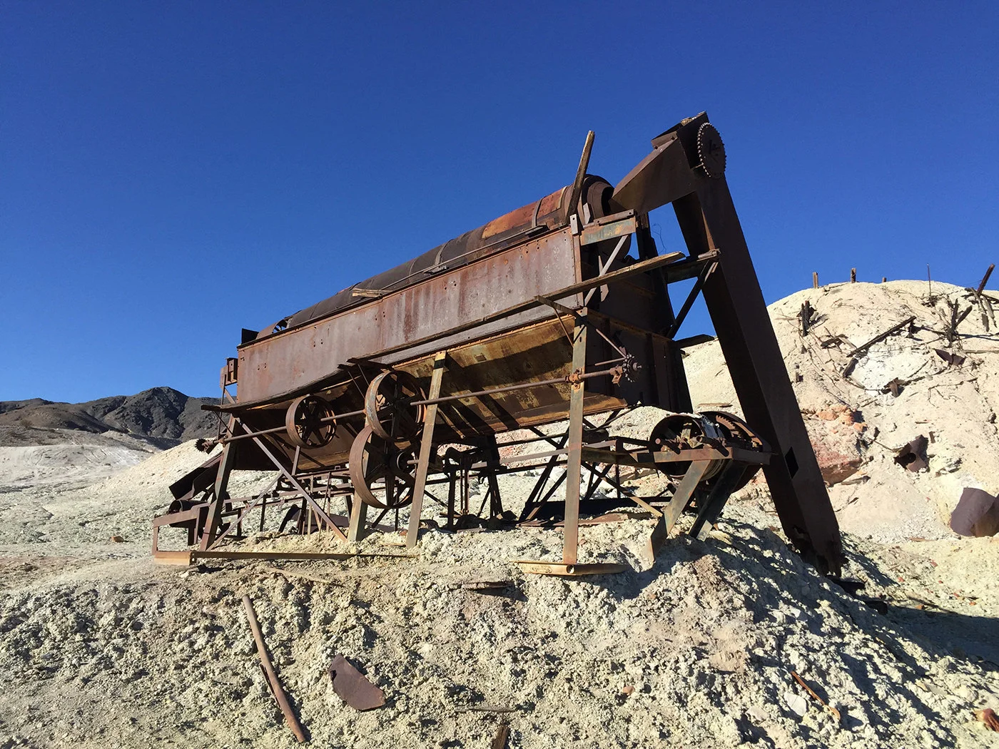
Abandoned mining machinery.

Probably a sulpher mine.

Abandoned mineshaft.
Next Trip: Angeles Chapter Desert Peaks Section trip to Clark Mountain May 2016. Trip leaders Alexander Smirnoff, Beth Epstein
Clark Mountain (7,933 ft) is the highest peak of the Mojave National Reserve.

Beth and Alex discuss the best approach.


View to the North. At night the glow of distant Las Vegas might be visible.